Williamsburg and Greenpoint are the most toxic neighborhoods in Brooklyn, and soon there will be map to prove it!
A group of environmental avengers are building a new map that pinpoints all the toxic hot spots in the two formerly industrial neighborhoods and here is a spoiler alert: there are a hell of a lot of pins.
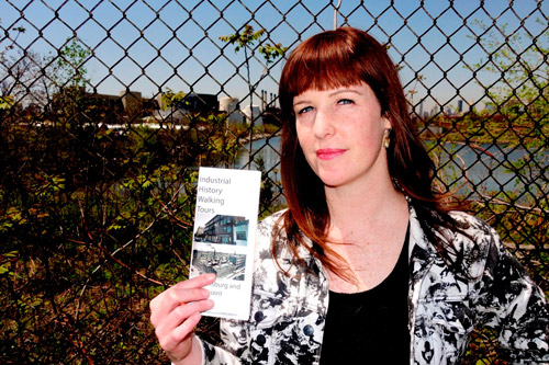
“We have found all kinds of terrifying things,” said Jennie Romer, who is the environmental organizer for Neighbors Allied for Good Growth, the head cartographer.
The mapping project is the culmination of years of concerns about the toxicity of the neighborhoods, which are the most polluted in all of Brooklyn thanks to years of abuse by industry, said organizers who claim the areas with polluted soil and chemicals are not limited to the filthy Newtown Creek.
“We knew over the years a lot of what was happening, but there was no single way before now to understand the entire industrial legacy,” said Ward Dennis, who is also working on the map. “It is important for people to know that the toxic spots are not just in the factories on the waterfront or the oil spill.”
The junior Amerigo Vespuccis are currently sorting through hundreds of toxic spots that sprouted up during the industrial age of Brooklyn, including federal superfund sites, state superfund sites, state-regulated brownfields, and spills, to decide what will go on the map. It is a matter of balancing residents need to know with the worry that they will get turned off by all the information, said Romer.
“We do not want to overwhelm people,” said Romer. “Not everyone needs to know where every little spill was, but if someone lives right next to even a small spill, that matters to them.”
Spots on the map will include the former NuHart and Company plastics plant on DuPont Street in Greenpoint, the Greenpoint Terminal Market on West Street in Greenpoint, and the radioactive Radiac Research Corp. on Bedford Avenue in Williamsburg.
Even the new Starbucks on N. 11th Street between Bedford Avenue and Berry Street will get a mention for its dirty past.
The group received a $50,000 grant from the state’s Department of Environmental Conservation for the project. Romer and Dennis said the map should be ready for prime time this summer, when it will go up on the website nag-b
But for those who can’t wait to find out just how toxic things are, Romer will show off some of the sites during her industrial walking tour of the neighborhoods. See the small type below for all the excitement.
NAG’s Industrial History Walking Tours meet at Grand Ferry Park (where Grand Street meets the East River in Williamsburg), May 16 at 1 pm and at Chelsea Fiber Mill (1175 Manhattan Ave at Commercial Street in Greenpoint) May 17 at 11 am. Free, but RSVP at walki