After the federal government abruptly abandoned a $19 million feasibility study of a storm resiliency barrier off the coast of southern Brooklyn, some experts have begun to consider smaller-scale, localized techniques to protect the borough’s low-lying coastal communities from flooding.
Here are some of the options they’ve floated:
Restoring Wetlands
Oyster reefs
These hard, natural barriers comprised of oysters— either living or old shells — can absorb wave strength which would otherwise head to the shoreline. As the oyster’s habitat grows it also becomes a sturdy shelter for other marine life, which stands in contrast to environmentalists’ worries that a man-made seawall would negatively impact marine animals. A healthy oyster population also has the added benefit of filtering water for pollutants and nitrogen, which an excessive amount of can trigger algal blooms that are known to deter marine life. The Billion Oyster Project has planted over a million oysters on shorelines around Brooklyn including Coney Island Creek in 2019, Bush Terminal Park in Sunset Park in 2016 and Brooklyn Bridge Park
Levees and berms
Obstacles such as berms and levees can be constructed along shorelines to block unwanted floodwater from entering the business and residential areas. Typically constructed using earthen material, the flood-mitigation technology is heavily utilized in “The Big U” resiliency plan for Lower Manhattan. If implemented, the “Battery Berms” would create a continuous, upland park from the Brooklyn Bridge to the Battery while simultaneously protecting the heavily-populated area from flood damage. Some experts have warned of the potential damage a community could face in the event that a levee or berm was demolished by a sufficiently powerful storm, thereby resulting in a massive flood event that would inundate coastal areas.
Evacuation
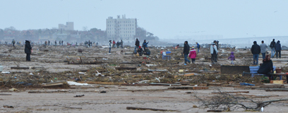
As the risk of sea-level rise reaches critical levels, some experts are seriously considering the wholesale evacuations of some high-risk coastal areas. Federal flood maps — and not to mention, history — show that areas in Coney Island, Bergen Beach, Manhattan Beach, Sheepshead Bay, Marine Park, Mill Basin, Red Hook Brooklyn Heights, Williamsburg, and Greenpoint are all subject to intense tidal surges during disaster-level storms, and, while the idea of abandoning several billion dollars worth of real estate sounds ludicrous, the prospect may become less crazy as the ice caps continue to melt, sea levels rise, and major storms become more commonplace. What legal mechanism would be used to achieving these evacuation zones is anyone’s guess, although likely candidates include eminent domain, federal buyback programs, or new zoning limitations designed to scare off developers. But what’s clear is that any decision to evacuate one of the most densely populated regions on earth is a choice between the lesser of two evils.