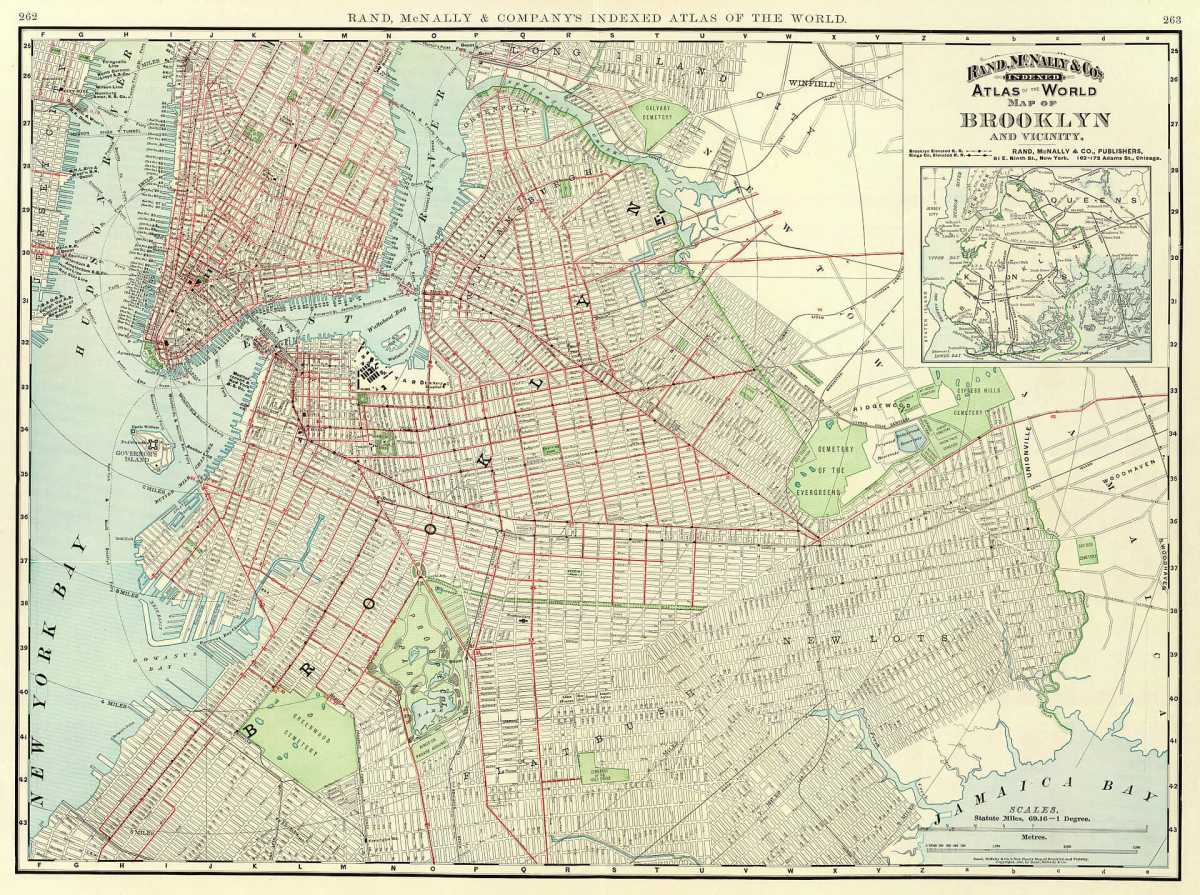
Take a trip around the 70 square miles of Brooklyn, and you’ll find a wide range of vibrant cultures and distinct architectural styles encapsulated within the artificial lines that slice-and-dice the borough into particular neighborhoods, with unique characteristics shaped by their histories, and marked by their monikers.
Beyond their convenient application of identifying geographic locales within the sprawling concrete jungle, neighborhoods names provide much more — they also give curious historiographers a look into the horrifying historical prominence of Brooklyn’s slavers, the history of redlining and real estate, the cultural self-segregation by race, and the infrastructural marvels that cutoff one place from another to create the modern mosaic that is Kings County’s cityscape.
Yet, many reside in neighborhoods whose namesake is an elusive mystery to them. So, for inquisitive Brooklynites, here’s how the borough’s neighborhoods got their names:
Carving up ‘South Brooklyn’
Until the 1960’s brownstone renaissance, the swath of Brooklyn stretching from Red Hook to Atlantic Avenue, and from the waterfront to Prospect Park, was known as “South Brooklyn” — a geographically confusing term, given that the neighborhood was located in the northwestern part of the borough.
That label dated back to the era when Kings County was a patchwork of towns, but ended when creatives and professionals snatched up historic brownstones, and sought to distinguish their communities from the working-class associations of South Brooklyn, with real estate interests eager to play along.
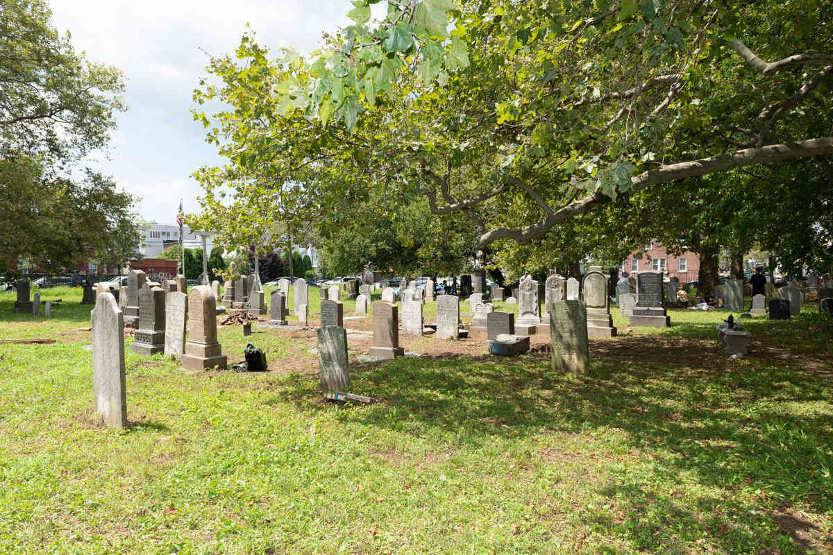
Those who settled in the enclave bordered by Smith Street, Atlantic Avenue, and Warren Streets dubbed the area Boerum Hill — named for the Boerum family colonial farm, which occupied most of the area from the time of Dutch settlement. The 1790 census shows the family owned at least two enslaved people.
In 1959, those living West of Smith Street revived the area’s historic name of Cobble Hill, which had previously died out by 1880.
Farther south, some residents of the historic brownstone neighborhood sandwiched between Red Hook and Gowanus sought to distinguish themselves from their industrial neighbors with a new identity, and came up with Carroll Gardens — named after the neighborhood’s uniquely long front gardens that lined some of its Brownstone blocks, and for Charles Carroll, the only Catholic signer of the Declaration of Independence, who already had Carroll Street and Carroll Park named for him.
Red Hook, for its part, maintained the same name since European settlement despite being a part of South Brooklyn. Its name was an anglicization of the Dutch Roode Hooek after the abundant red clay in the area and the jagged peninsula that still juts out into New York Harbor
Gowanus, named for Gauwane, a Canarsee Indian, has also maintained roughly the same moniker since Dutch occupation.
Park Slope, meanwhile, remained nameless as it was rapidly developed throughout the late 19th century, with residents there eventually settling on the name after considering a variety of others. It is understandably named for the hill which the area sits on, that begins to slope downward from the park.
Dutch roots, and the remnants of slaveholders
The name Brooklyn itself comes from Breukelen, the Dutch village in the Netherlands. And continuing in that vain, more than one Brooklyn neighborhood was named by the Dutch, only to be anglicized once the British took over.
Flatbush, one of the original towns that were consolidated into the City of Brooklyn, was named V’Lacke Bos by Dutch settlers, meaning ‘a plain with woods’ as our sister website Brownstoner explained in 2016. When the British took over, they changed the name to Flatbush — which sounds similar to the Dutch name when said out loud.
Bushwick, another of the original towns, was dubbed Boswijck by New Amsterdam director-general Peter Stuyvesant in 1661, meaning ‘neighborhood in the woods.’ The British continued their practice of anglicization when they took over, as they did in Midwout, which translates to, you guessed it, ‘middle woods.’
Coney Island was christened Conyne Eylandt, translating to ‘rabbit island’ for its large population of rabbits.
The town of New Utrecht, named for the Dutch city of Utrecht, was renamed Bensonhurst in the late 19th century after landowner and politician Egbert Benson.
Stuyvesant’s name has been immortalized in Bedford-Stuyvesant, making the neighborhood one of the many New York City neighborhoods and streets named after slaveholders. Gerritsen Beach, named for Dutchman Wolphert Gerretse is another, as are Boerum Hill, and Prospect Lefferts Gardens, named for the Lefferts Family who farmed the area. Bergen Beach was named for Dutch settler Hans Hansen Bergen, who oversaw the earliest Tobacco plantation in Manhattan before decamping to Brooklyn.
The English leave their mark
Brooklyn’s neighborhood names reflect the occupation of the British just as closely as the Dutch, with ‘Kings County’ perhaps the most prominent example.
Gravesend, founded as a colony of English settlers by Lady Deborah Moody fleeing religious persecution, is thought either to be named for the English port of Gravesend, or for the Dutch word for ‘groves end.’
Nearby Bath Beach, founded as a seaside resort is said to be named for Bath, Somerset. Brighton Beach was similarly named for the English seaside town of Brighton.
Other neighborhoods were named out of developers’ desire to attract a sophisticated crowd. Kensington was named after the London neighborhood when it was developed in the late 19th century, which the developers figured would give the neighborhood a cosmopolitan reputation. The developers of Windsor Terrace followed the same logic.
Canarsie
One of the only New York City neighborhoods named for its original inhabitants, Canarsie was once one of the main villages of the Canarsee Indians, who fished its shorelines for oysters and grew corn on its flat plains. As late as the 1930’s immense heaps of oyster shells could be found at the historic site of the village.
Keep it simple
Plenty of Brooklyn neighborhoods were named for their geography, their geographical features, or nearby landmarks. Flatlands is obvious enough — it’s a flat plane, while Bay Ridge is seated atop a high ridge above the water, as is Brooklyn Heights.
Mill Basin, once called Mill Island, was once home to the Mill of Martensen, while Sheepshead Bay is named for its abutting body of water, which was once rich with the fish called Sheepshead.
Sunset Park was named for the park of the same name, where elevated views of New York Harbor and Manhattan make for one of the best places to see the sunset in the city, while Marine Park also takes its name from its prized park.
Borough Park was named in 1902, though the reasoning is unclear.
Crown Heights, once known as Crow Hill, changed its name once Crown Street was christened.
Perhaps the most simple of Brooklyn’s neighborhood names, East New York was named by merchant John Pitkin to signify it as the eastern end of New York City.
‘The Hill’ gets its due
What is now Fort Greene Park was once the site of Fort Putnam, later renamed Fort Greene for General Nathaneal Greene who supervised the construction of the fort. During peacetime in the 19th century, locals, led by then Brooklyn Daily Eagle editor Walt Whitman led a successful campaign to have the fort officially turned into parkland.
Clinton Hill, once lumped in with Fort Greene in an area known as ‘The Hill’ was named for Clinton Avenue, which is in turn named for New York Gov. Dewitt Clinton.
Williamsburg/Greenpoint
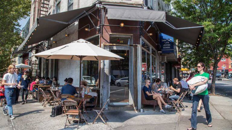
A cafe in GreenpointamNewYork
Once part of the town of Bushwick, Williamsburg was named for its surveyor, Colonel Jonathan Williams. Richard Woodhull, who owned much of the land that made up the northern neighborhood, assigned Williams to the job and named the land after him in his honor.
Brooklyn’s northernmost neighborhood, Greenpoint, was named for its leafy appearance. Sailors passing by the area noticed a green piece of land sticking out into the water — a point of green. The name was later applied to the whole area, according to Brownstoner.
In one’s own honor
Before it came to be known as Brownsville, it was known as Brown’s Village, where developer Charles S. Brown purchased land and took the liberty to name it after himself. The developer marketed the neighborhood to Jews on the overcrowded Lower East Side as a neighborhood with open space and fresh air.