By February, you’ll never be lost in Downtown again — thanks to dozens of giant map kiosks that only took 10 years and $1.4 million to erect.
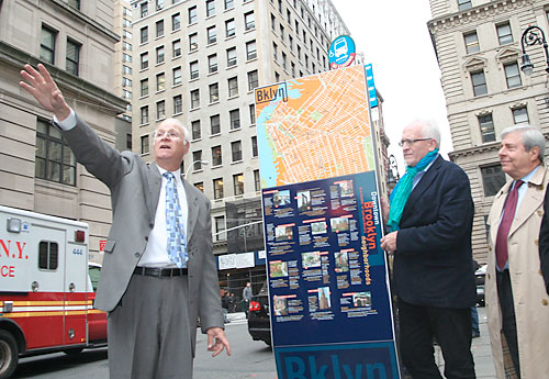
The Metrotech Business Improvement District unveiled its Wayfinding Sign System — a cool way of saying, “maps” — on Tuesday, revealing a wall of information and directional signage near Borough Hall on Joralemon Street.
Of course, the signs are only two of 78 installations planned for completion after the new year — an old-school solution to a age-old problem that an iPhone app couldn’t fix, planners said.
“It’s sort of a belt-and-suspenders approach — but we want to give a quick message to pedestrians, and help them get to points of historic interest fast,” said project designer David Gibson of Two Twelve Associates.
The BID has been touting the new navigation tool — which towers at more than six feet tall and boasts pictures of historic buildings, along with a map — for more than 10 years.
Gibson said that the process was delayed by constant meetings with the community board, the Landmarks Preservation Commission and the Public Design Commission over that span. Money was a factor too, until the city Economic Development Corporation chipped in the $1.4 million to finish the job.