“It was baking. Blazing hip-hop and R&B, that’s how hot it was.”
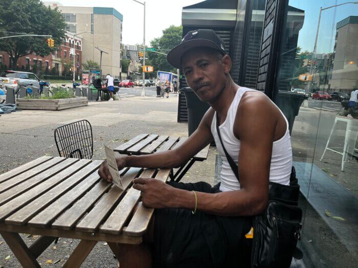
Bernard Rush sits outside a cafe in Crown Heights. He hasn’t gone far from his table, which stands under the thick cover of a green ash, all day — mostly out of necessity. Even late into the afternoon on Thursday, Sept. 7, the third day of an unusual September heat wave, the mercury hovered around 90 degrees Fahrenheit, restricting Rush and his friends Karim Davenport and Mede Mack to the safety of the tree canopy.
Not that their current situation bothers them.
“I don’t mind the heat. As long as I can get some water, some coconut water or something and find a little bit of shade, I’m good,” Davenport said.
The world saw its hottest summer on record this year. New York, however, had a cooler-than-expected summer, with temperatures rising above 90 degrees on only a few occasions in July and August, traditionally the city’s two hottest months.
Heat built up over central and southern U.S. was the culprit, explained Nelson Vaz, meteorologist at the National Weather Service in New York.
“We were being excluded from that,” he told the Brooklyn Paper.
Changing weather patterns then led to high temperatures at the beginning of September, bringing higher-than-normal temperatures as school started.
Hotter summers are set to become the norm
For Brooklynites, summers like this one will soon be a thing of the past. As greenhouse gas emissions continue to increase, longer and hotter heat waves are expected.
According to First Street Foundation, a Brooklyn-based nonprofit, by 2050, Brooklyn will have 46 days with temperatures over 90 degrees and 11 over 100 degrees.
The Mayor’s Office for Climate and Environmental Justice, in its 2023 “PlaNYC: Get Sustainability Done” report, projects that by the 2050s, New York will see, at a minimum, a month’s worth of days above 90 Fahrenheit.
Today, there is a 50% chance a heat wave — characterized as three or more days in a row with highs of 90 degrees or above — will occur in a given year. In 30 years, heat waves are projected to occur in eight out of every ten years.
The consequences will be varied. Some health risks increase as temperatures rise: cramps, heat exhaustion and heat stroke are all possible above 90 degrees Fahrenheit. As temperatures rise, so does the need to run the air conditioner.
Over the next 30 years, residents of Brooklyn are expected to need to increase their electricity usage to cool their homes and offices by around 19%, and the number of cooling days will increase from 148 to 160.
But the effects of the climate crisis are not equal across geography, race and socioeconomic groups. In 2017, large parts of Brooklyn, particularly some of the central, northern and northeastern neighborhoods, had limited access to air conditioning.
The unequal distribution of the climate crisis’ adverse health effects doesn’t stop there. Black and low-income New Yorkers are twice as likely as their white neighbors to die from extreme heat, a result of systemic racism that has led to a “lack of equitable access to resources needed for wellness,” according to the “2023 NYC Heat-Related Mortality Report.”
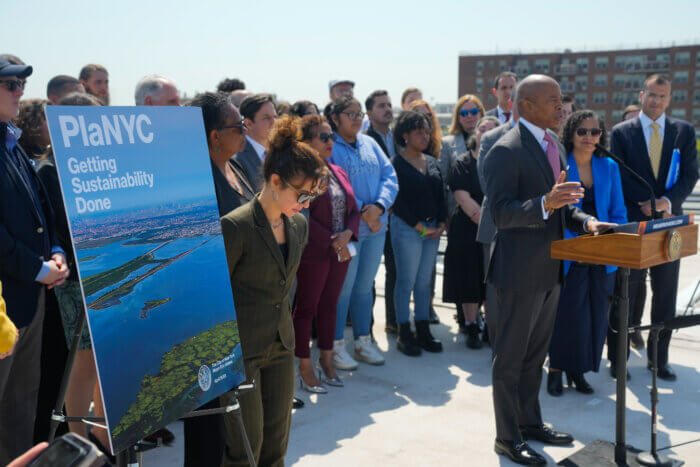
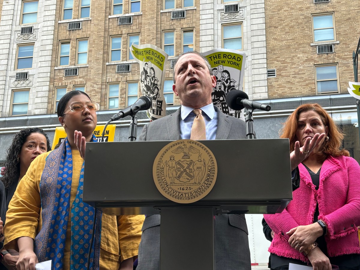
“Climate justice, to me, is a racial justice issue,” said New York State Assembly Member Brian Cunningham, adding, “When you look at communities that are mostly Black and brown, they have been the ones who have shouldered the burden of climate injustice for far too long.”
Cunningham’s District 43 includes several neighborhoods disproportionately affected by extreme heat. Crown Heights is one of them, with a Heat Vulnerability Index of four out of five. Prospect Lefferts Gardens, which also lies within District 43, scores a five, making its residents some of New York’s most vulnerable to extreme heat.
Planting trees to reduce these “heat islands” — urban areas with few trees and little or no access to green spaces — is necessary, Cunningham said. “That would make the space cooler but also deal with issues like asthma and humidity in the district.”
To cool the city, the Mayor’s Office plans on installing one million cool roofs annually and planting more trees, hoping to reach a canopy coverage of 30%. When this target should be met has not been decided on, but 2035 has been proposed by Forest for All NYC, a coalition of advocates and researchers.
The lofty goals are achievable, a spokesperson for the Mayor’s Office of Climate & Environmental Justice said in a statement to the Brooklyn Paper. Speaking on cool roofs, the spokesperson noted, “We have achieved this goal several times over the past decade, so we believe it remains an ambitious but achievable goal.”
Storms and flooding will intensify, too
Extreme heat isn’t the only hazard primed to impact Brooklyn more intensely in the decades to come. Torrential rainfall and flooding, too, will become more prevalent.
Climate scientists are still studying the connection between climate change and hurricanes, and the jury is still out on whether a warming planet increases the number of hurricanes. So far, no increase has been observed; in fact, when looking at the whole globe, the total number of hurricanes has decreased slightly.
But as rising air temperatures heat the oceans, storms become more intense. Since 1975, the number of storms becoming Category 4 or 5 cyclones has roughly doubled.
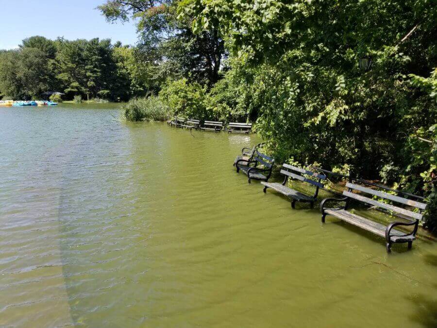
A hot atmosphere is also better at holding moisture: for every degree Earth’s temperature rises, the atmosphere can retain 7% more water vapor. More moisture in the air means more rain. Coupled with rising sea levels — it’s expected to rise between one and two feet in the New York area — a perfect storm is created.
“If you have a higher base with a higher sea level, there is potential for higher magnitude storm surge events, and also, higher potential for more extreme rainfall events is there from either tropical or nontropical activity,” Vaz said.
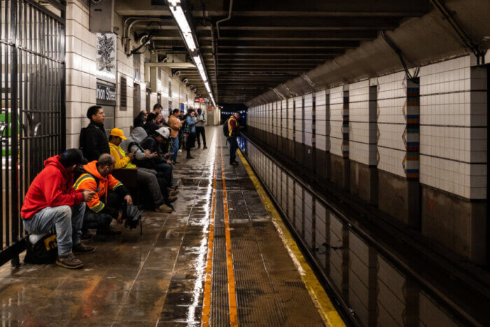
Brooklyners, especially residents of Gowanus, Park Slope and the Brooklyn Navy Yard, saw the effects of this kind of extreme weather firsthand in the last days of September, as tropical storm Ophelia battered the city during the evening of Thursday, Sept. 28 and through the morning of Friday, Sept. 29. Between 8 a.m. and 9 a.m. on Friday, 2.58 inches fell over the Brooklyn Navy Yard.
That’s almost an inch more than New York’s drainage systems could handle — its limit is 1.75 inches per hour — leading to widespread and severe flooding which stranded commuters and destroyed property.
New York can expect more storms like this one, explained Vaz. Nowhere in the country has seen a more significant increase in these rare extreme rain events than the Northeast over the past 60 years.
In the last decade, four 500-1000-year storms have hit the region. In 2014, Islip, NY, on Long Island’s southern shores, saw historic rainfall and in 2021, Post Tropical Depression Ida flooded the tri-state area in early September after making landfall in Louisiana — then as a Category 4 hurricane — a few days earlier. Connecticut and the Lower Hudson Valley have also seen torrential downpour and flooding in the last five years.
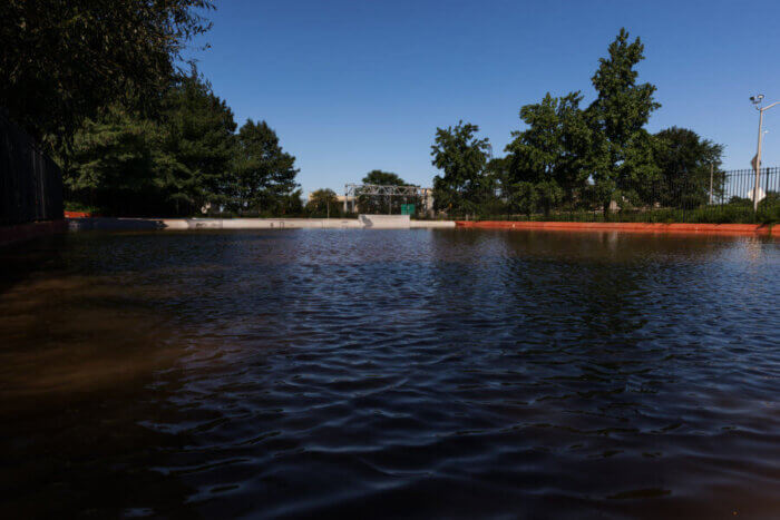
New York will see between 4 and 11% more precipitation by 2050, according to the Mayor’s Office. But what projections are also showing, noted Vaz, is that, as the planet warms, a larger portion of annual rainfall will come during extreme events, like the one in late September.
Videos from Gowanus shared on social media showed cars flooded by several inches of water at the intersection of Fourth Avenue and Carroll Street.
“There was a massive amount of water on the street. A lot of businesses were flooded and were trying to manage the flooding as it happened. It was a mess,” said Andrea Parker, executive director of the Gowanus Canal Conservancy, a local environmental stewardship group, describing the scene that met her on her way to the office.
Gowanus is one of the neighborhoods most vulnerable to flooding in the city: it’s located downhill from Carroll Gardens to the west and Park Slope to the east, meaning it has to deal with not only its own stormwater but also that which drains from upslope.
Improving flood resiliency
For decades, the city has been lagging in its response to the recurring flooding in the neighborhood. Now, several projects are ongoing to improve stormwater resiliency and clean up the Gowanus Canal — one of the nation’s most contaminated bodies of water — on federal, state and city levels.
In 2010, the Environmental Protection Agency declared the canal a Superfund site, a federal program for cleaning up the most contaminated areas in the U.S. Several projects are now underway, including the construction of two sewage retention tanks, designed to address the problem of combined sewage overflows.
About 60% of New York City has a combined sewer system, where both stormwater and sewage flows through a single pipe. Combined sewage overflow events occur when the drainage system has to carry more water than it can handle — like during rain storms. Such events send sewage water out directly into the canal instead of to the treatment plant, which can wreak havoc on the aquatic life that calls the canal home and leave it with a foul odor.
When the city council approved the rezoning of Gowanus in 2021, it also made several commitments to improve the stormwater infrastructure in the neighborhood. The commitments included applying the Unified Stormwater Rule to all new developments in the area, requiring developers to manage stormwater on-site.
Critics have argued that the city isn’t taking into account heavier rainfall due to climate change and increased stress on the sewage system from the 8,500 apartments that will be added to the neighborhood once the rezoning is complete.
Parker, however, highlighted the success of the advocacy efforts around the rezoning. The scale and range of the commitments made by the city are unprecedented, she said.
“It’s not just public housing or just sewers or just park space — it’s all of them.”
The Unified Stormwater Rule will make a drastic difference, she explained. The sewage system can handle the flushing and showering of the additional 20,000 residents that will move into the neighborhood over the next 12 years, as long as it doesn’t also have to transport stormwater.
Still, Parker noted, current efforts aren’t enough to address the flooding the city will see in the future. A long-term, multi-pronged strategy that includes improved on-site stormwater and flood management in older buildings, larger sewers and quicker, better emergency response when flooding occurs, is required.
She also wants spongier infrastructure in the surrounding upland neighborhoods, which can hold their own water instead of letting it run downhill to Gowanus.
“It’s switching from thinking about a sanitary city where we’re trying to immediately suck all the water away,” she said, “to a more sustainable city that has areas that can actually hold water in the city itself.”
Gary Francis, captain of the Gowanus Dredgers Canoe Club, walks along the canal every morning, taking stock of the health of the water. He does so, in part, to see what works and what doesn’t.
Where Second Street meets the canal, a park has been constructed to help with the stormwater runoff. As water travels down Second Street, it passes through soil, plants and rocks before it enters the canal. This way, some pollutants are removed and the runoff is redirected and slowed, reducing overflows.
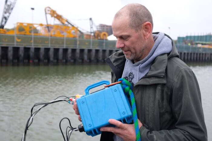
On a rainy Friday morning, Oct. 20, Francis measured, among other things, the salinity of the canal at Second Street. It has dropped somewhat from the day before when it didn’t rain. He suggests the possibility that the freshwater that has run through the park has lowered the salinity. It also adds oxygen, he said.
“If I can note that and say, ‘This is the kind of shoreline, the kind of street end we need. All street ends should look similar to this,’ then that’s a good thing.”
He also highlighted that, while human intervention is necessary, nature can help heal itself. The canal is home to hundreds of thousands of Atlantic ribbed mussels, which each can filter up to 15 gallons of water a day.
“They’re actually offsetting combined sewage overflow,” Francis said.
Storm surge threatens communities on the coast and inland
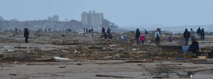
In the past decade, a concerted effort has also been made to protect New York’s coastal areas from storm surges — a natural strategy, given the catastrophic destruction Superstorm Sandy left in its wake when it wreaked havoc on New York in October 2012.
Melissa, 27, who asked only to be referred to by her first name, lives in Dyker Heights but used to live in Gerritsen Beach and went to school in Coney Island. She was right there when Sandy struck the New York coastline.
“It was really bad,” she said. “There were people in kayaks going down the block.”
An elderly couple that lived near her got trapped in their attic as the floodwaters rose.
“And they didn’t even know how to swim, so the people with the kayaks were coming by to swim into their house to help them get to our other neighbor who at least had a second floor,” she said.
The spokesperson for the Mayor’s Office said that the city is working on several projects, including cloudburst efforts and flood sensors. In Red Hook, the Red Hook Coastal Resiliency project hopes to protect the area from coastal storm surges and improve the long-term resiliency of the neighborhood.
The U.S. Army Corps of Engineers also plans on erecting coastal barriers along 41 miles of New York’s shoreline, including in Brooklyn. This effort is part of a 14-year construction plan estimated to cost $52 billion.
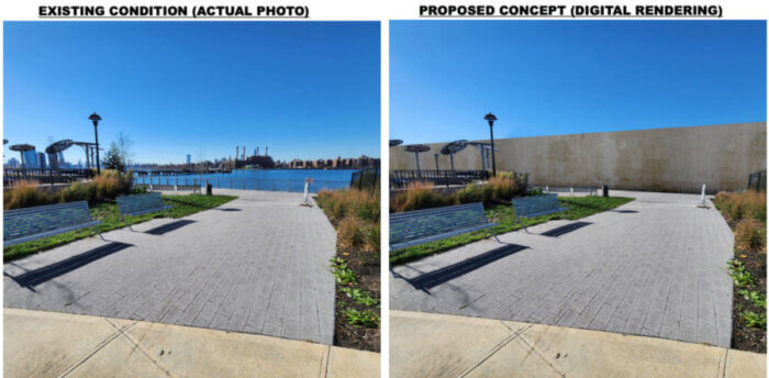
Yet, the HATS study — short for New York and New Jersey Harbor and Tributaries Study, the formal name of the Army Corps’ proposal — has inadvertently narrowed the focus of the city’s flooding resiliency efforts to coastal protection, said Parker.
Part of the Gowanus Canal Conservancy’s advocacy efforts has, therefore, been aimed at broadening the scope.
The lack of a comprehensive plan highlights the complexity of navigating the effects of climate change.
Several challenges complicate the issue in New York, Vaz said, including the high amount of impervious surface, which limits how much green space can be added, and aging infrastructure that’s vulnerable to torrential rainfall.
“Another challenge is that we’re in an area that’s vulnerable to sea level rise, too,” he said.
Rising sea levels will impact coastal communities not only during future storms. In the upcoming decades, some low-lying communities will experience chronic flooding. In 60 years, high tide will flood parts of neighborhoods like Canarsie and Bergen Beach.
“We need to encourage communities to think long term about not just the next 10 or 20 years, but where are we going in the long term?” explained Jeff Peterson, co-facilitator of the Coastal Flood Resilience Project, a coalition of nonprofits working for stronger national programs to prepare for coastal storms and rising sea levels. For future development projects, sea level rise must be part of the equation, he added.
When permits are issued for new houses in coastal areas, he said, cities must consider that while some areas may not be inundated in the next decade or two, they might be in 50 years.
The same goes for new infrastructure.
“Where are we locating principal infrastructure assets? And energy facilities, where do they go so that they’re not at risk of sea level rise?” Peterson said.
Ecosystems like wetlands, marshes, beaches and dunes must also be considered, adding to the complexity of improving flooding resiliency.
“Planning for flooding resiliency under the impacts of climate change is challenging due to the diverse and dynamic nature of the threats posed by both rainstorms and coastal storm surges,” wrote Michael Embrich, deputy chief of public affairs at the U.S. Army Corps of Engineers In a statement to the Brooklyn Paper.
They also require different mitigation strategies, he stated.
Coastal barriers are only a temporary solution, argued Peterson. Long-term, sea level rise and its effects on future housing developments, critical infrastructure and ecosystems — as well as how they relate to one another — must receive more attention, no matter how complex it is.
“Until you think through all three of those things, you can call it planning, but it isn’t really comprehensive planning,” said Peterson.
Melissa worries about her family, who still live near the waterfront.
“A lot of people raised their houses after Sandy. But that takes a lot of money, too,” she said.
Her parents didn’t raise their home.
“If it does happen again,” she pondered. “I mean, they’re still trying to repair all that damage.”


