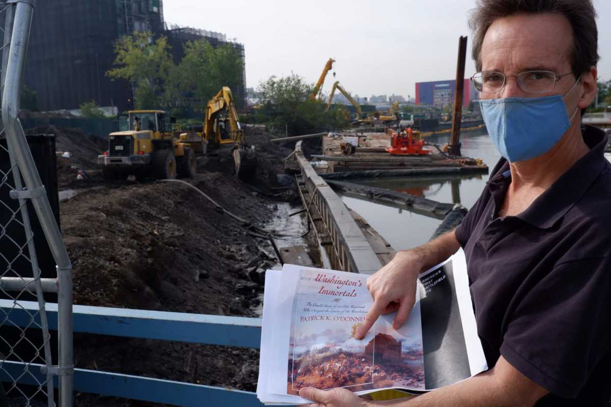
The remains of soldiers who perished in the 1776 Battle of Brooklyn could be buried beneath plots of land at the Gowanus Canal, according to one local history buff, who urged government officials to deploy archaeologists to monitor the possible resting place for America’s first war dead — just as private developers and the federal Superfund cleanup program start digging into the hallowed grounds.
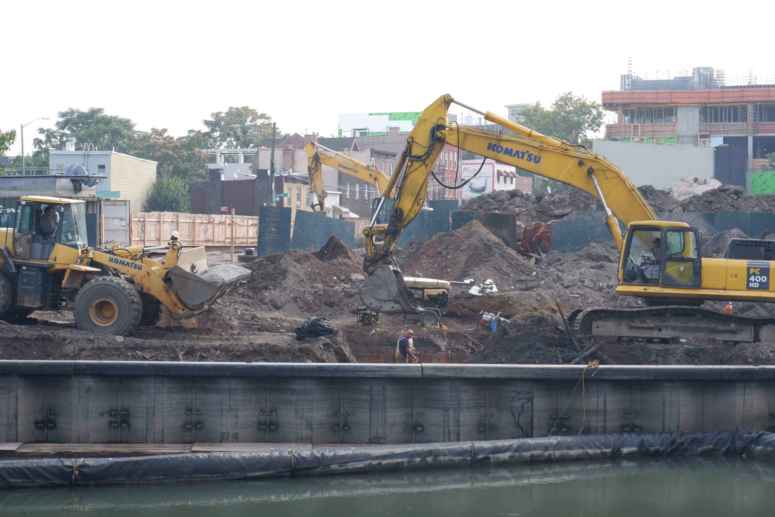
“Right now we have bulldozers going into what is the 1776 Battle of Brooklyn site and potentially its burial ground,” said Eymund Diegel at a Sept. 22. meeting of the Environmental Protection Agency with the local watchdog group for the cleanup, the Gowanus Canal Community Advisory Group. “There’s no coordination whatsoever for what is probably one of the most archaeologically sensitive sites in Brooklyn.”
Diegel, a Gowanus canoer, water sampler, and self-styled “forensic geographer,” claims the bodies and other historic artifacts are buried in the area south of the Carroll Street Bridge, stretching roughly to the rear of Whole Foods Market near Third Street.
There, said Diegel, may lie some of the corpses of the Maryland 400 — a band of revolutionary-era soldiers that held the line against the British for long enough to allow Gen. George Washington and the rest of the Continental Army to retreat toward Fulton Ferry Landing and across the river to the distant isle of Manhattan.
As the leading conflict after the Declaration of Independence, the fallen soldiers were the first to die as Americans, as opposed to colonial subjects rebelling against the monarchy.
Diegel triangulated the battleground’s Gowanus location by overlaying old military maps with the modern street grid and identifying the area around the early 18th-century tidal mill known as Denton’s Mill as one of the hotspots of battle where Americans fled across the pre-industrial marshlands.
To further illustrate his claims, he showed a 1858 painting of the site during the Aug. 27 battle that often graces the covers of history books about it, which shows Red Coats chasing Revolutionaries into the water.
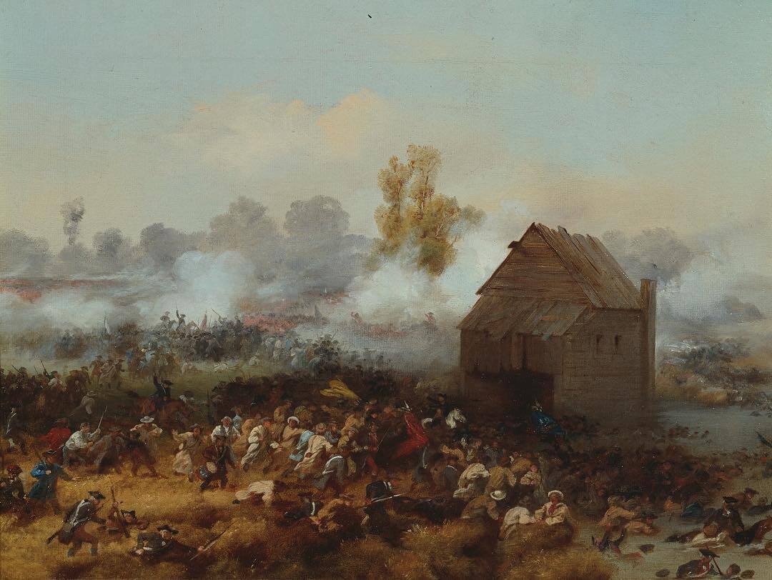
Many documents from the time indicate that troops fled through that area, according to Kim Maier, the executive director of the Old Stone House museum, who cautioned against relying on the painted portrayal because it is not a primary source document as artist Alonzo Chappel created it more than eight decades after the fact.
“It’s not a primary source document, but we do know from letters and reports at the time that that was the escape route and that men were drowning,” said Maier, whose Park Slope museum focuses on Brooklyn’s role in the Revolutionary War.
The Brits likely interred the “traitors” on the spot in the August heat, according to Maier, rather than gather them all in one mass grave, so their carcasses are probably more spread out across the battlefield which stretched all the way to Green-Wood Cemetery.
Around 256 of the Maryland 400 were either killed or went missing in the skirmish, and their final resting place remains one of history’s great mysteries, Maier said, and several others have claimed to have found potential burial sites.
One high-profile candidate was beneath a vacant lot slated for a new pre-school on at 201 Ninth St., between Third and Fourth avenues, where Brooklyn Heights historian Bob Furman contended the Maryland 400 could be buried.
Maier noted that for the site near the Carroll Street Bridge, “The potential is really there,” due to the marshlands being on their path of flight, but added that the battlegrounds have been moved around when the old winding tidal creeks were dammed and channelized into the 1.8 mile modern-day canal during the mid-19th century.
Two of the canal-side lots are currently being redeveloped by private owners, and the Environmental Protection Agency plans to excavate the former canal offshoot known as the First Street Turning Basin and turn it into wetlands as part of the channel’s federally-supervised scrub.
The site immediately south of the Carroll Street Bridge is being dug out by builders and excavators, with some holes going six feet underground. Manhattan developer Domain Companies owns the lot, which is currently zoned for manufacturing, but could house a mixed-use residential and commercial building under the impending Gowanus rezoning.
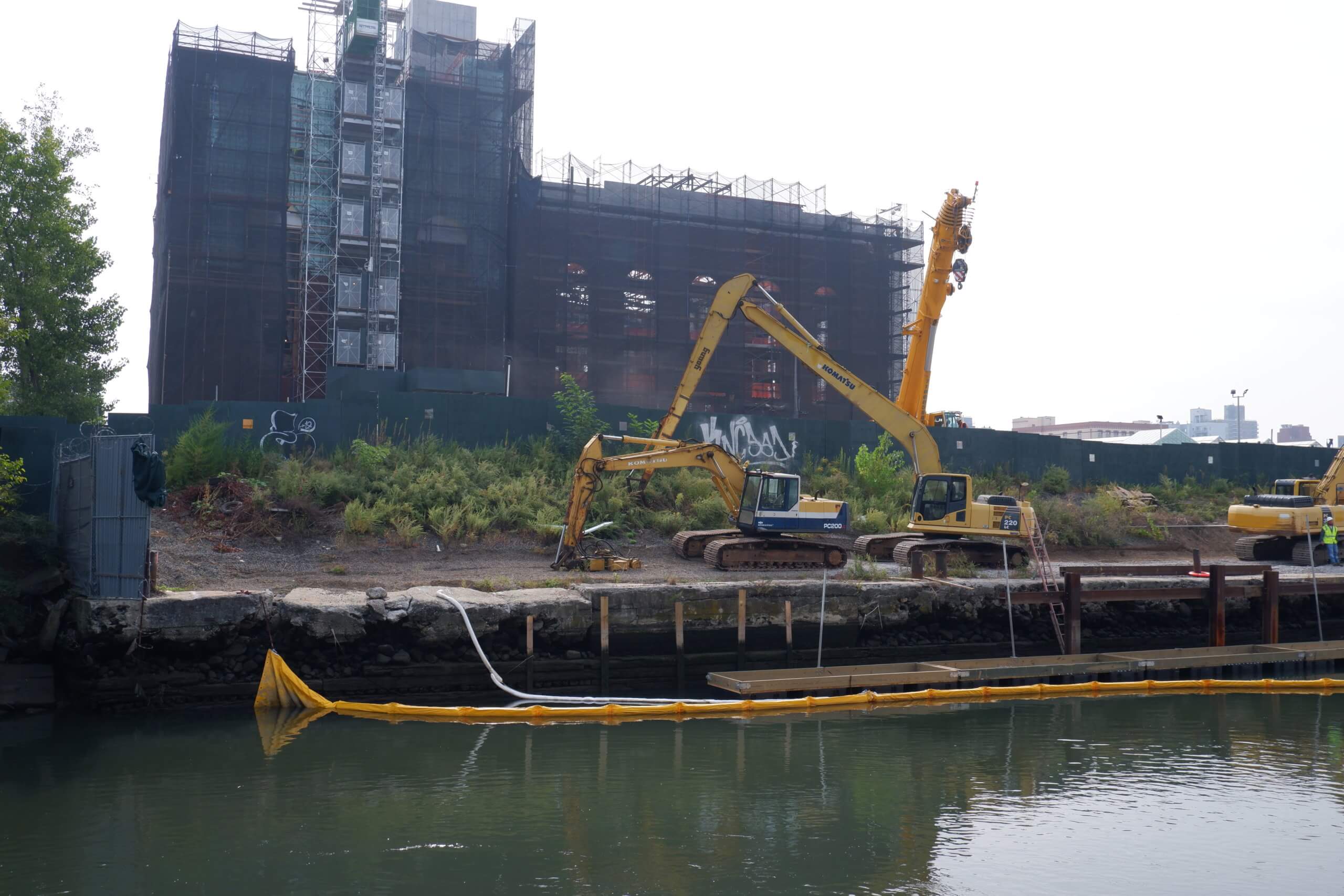
South of the turning basin lies the 19th-century coal burning power plant known as the Batcave, which nonprofit Powerhouse Arts and philanthropist Joshua Rechnitz plan to convert into a sprawling art space.
Neither developer immediately responded to requests for comment.
At the Tuesday CAG meeting, EPA officials said that construction around the site wasn’t going to historic depths, but that if it did, there would need to be some sort of “archaeological requirements.”
“It is not our understanding that any of the work is going to historic levels, it is all happening at an essentially superficial level,” said agency lawyer Brian Carr. “If anything is disturbed at a deeper level then, yes, absolutely there needs to be all the archaeological requirements take place.”
But Diegel hopes to get the State Historic Preservation Office or the federal American Battleground Protection Program — part of the National Parks Service — involved to oversee construction and ensure no remnants of the pivotal battle are lost or destroyed.
“It’s extremely likely that we will find battle relics there,” he said. “You have to do some careful archaeological digging there before you just go bulldozing and pile-driving there.”
SHPO and NPS did not immediately respond to a request for comment.
Correction (Tuesday, Sept. 29, 2:17 pm): A previous version of this story misstated that the lot immediately south of the Carroll Street Bridge is owned by Property Markets Group. The property is in fact owned by Domain Companies, which bought the site from PMG in 2018. Brooklyn Paper regrets the error.